
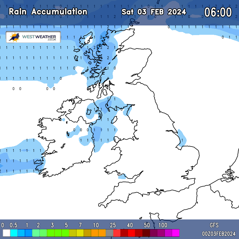
Rain accumulation chart for England
About this animated map
Our South West of England 10 Day Rain Forecast chart takes the best from the GFS weather models and displays it in easy to read maps out to the next 240 hours ahead (10 days).
Simply play or slide along to the time which you would like to see the forecast for and as if by magic the map will change to display the forecast. This information is updated every 6 hours.
This is a handy way of looking at a snapshot of how the weather will develop over the next few days and is updated every 6 hours. .
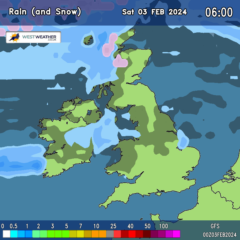
Rain accumulation chart for England
South West Warnings
No weather warnings have been issued for the South West at this time.

On This Day ...
| Record Temperatures On This Date | |
|---|---|
| Record High 32.3°C - 2013 |
Record Low -2.5°C - 2007 |
Today's extremes
| Monday 13 July | ||
|---|---|---|
| High Temp | 24.7°C | 7:04 PM |
| Low Temp | 13.7°C | 4:59 AM |
| Rain Rate | 0.00 mm/hr | 00:00 AM |
| Max Gust | 28.8 mph | 1:39 PM |
| Min Windchill | 13.7°C | 4:59 AM |